
Birka and Sigtuna are usually described through excavated houses, graves, imported goods, runestones and royal connections. A study published on August 21, 2026 suggests another source can help reconstruct the networks that made these towns possible: the names of places scattered across Lake Mälaren and the Stockholm archipelago.
Archaeologist Sven Kalmring examined maritime place-names connected with landing sites, ship types, defensive barriers, portages, navigation markers and warning beacons. Taken together, they suggest that Viking-Age travelers did not simply sail across an empty stretch of water until they reached Birka or Sigtuna. They moved through a developed maritime landscape containing recognizable stopping places, routes and strategic points.
That changes the scale of the story. Birka and Sigtuna were important ports, but ports depended on the waterways around them. The forgotten names along those waterways may preserve traces of the infrastructure that kept trade, travel and communication moving.
Birka Needed More Than A Good Harbor
Birka was established on Björkö in Lake Mälaren around the middle of the eighth century and became one of northern Europe’s leading Viking-Age trading centers. Its position allowed merchants to connect Scandinavian, Baltic and longer-distance networks.
UNESCO describes Birka as a hub of the extensive trading system created by Scandinavians during the Viking Age. Its importance was closely tied to geography: Björkö lay where several important waterways converged.
Yet studying the settlement itself reveals only part of that system.
Ships approaching Birka needed safe routes through coastal waters, places to land, recognizable passages and ways of negotiating an environment filled with islands, sounds and narrow channels. Kalmring’s new research asks what happens when archaeologists move their attention away from the town and study the broader maritime landscape that supported it.
His peer-reviewed study, The Sea Routes to Birka and Sigtuna, examines place-name evidence along the southern approach through Södertälje, across Södertörn, through the Stockholm archipelago and inside Lake Mälaren.
The result is a much denser picture of Viking movement.
Birka may have been the destination, but the route toward it contained its own network of places with specialized maritime functions.
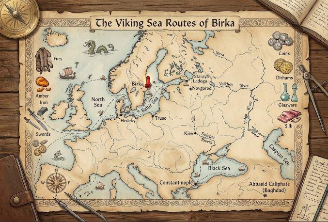
Ship Names Survived In The Geography
Some of the most revealing place-names preserve words connected with Viking and early medieval ships.
Kalmring examines names associated with snekkja, skeið and knǫrr. These were not interchangeable terms. They referred to different forms of vessels and maritime activity.
The knǫrr is particularly important. This was a large cargo vessel associated with long-distance transport rather than the narrower image of Viking warfare familiar from popular culture.
Names such as Knarrviken in Helgarö parish, Knarrastrom in Veckholms parish, Knarrnäs in Boo parish and Knarrhamn in Nämndö parish may preserve memories of places connected with commercial shipping.
The argument becomes stronger when place-name evidence is considered beside runic inscriptions. Kalmring notes references to knǫrr-type cargo vessels on runestones including U 214, U 258, U 654 and Sö 198.
None of this means every ship-related place-name can automatically be dated to the Viking Age. Names can survive, change or acquire new meanings over centuries. The value comes from patterns: linguistic evidence, geography, archaeology and historical sources can be compared rather than treated separately.
That approach turns place-names into clues about how commercial movement was organized outside the famous towns themselves.
The Viking Coastline Was Not The Coastline We See Today
Reconstructing these routes carries another problem. Viking sailors were moving through a landscape that no longer exists in exactly the same form.
Postglacial land uplift has steadily changed eastern Sweden. During the Viking Age, Lake Mälaren was still connected much more directly with the Baltic Sea. Areas that are dry land today could once have formed shorelines, channels or landing places.
Kalmring notes that the Viking-Age shoreline around Birka was roughly five meters above the modern shoreline, with the precise measurement depending on the elevation reference system used.
That difference matters when interpreting archaeological sites.
A modern map can make a former landing site appear strangely distant from water. A place-name may preserve a maritime function that has become difficult to recognize simply because the coast moved.
The wider importance of Birka’s waterways is supported by its archaeological setting. UNESCO’s Birka and Hovgården World Heritage record identifies surviving harbors and jetties among the site’s Viking-Age remains and describes Birka as one of northern Europe’s most important mercantile settlements between roughly AD 750 and 980.
Place-name research extends that maritime story beyond Birka’s immediate shoreline.
Sigtuna Inherited A Changing Maritime Network
Birka’s commercial activity ended toward the close of the tenth century. Sigtuna emerged at roughly the same time, traditionally dated to around AD 980, and became an important royal, commercial and Christian center.
That transition did not erase the waterways that connected central Sweden with the Baltic.
Kalmring examines the proposed Fyrisleden, a reconstructed system of approaches into Lake Mälaren and toward the settlements of Birka and Sigtuna. The route changed in significance as geography, shipping and political centers changed.
During the earlier Viking Age, southern approaches through Södertälje appear especially important. Later traffic could follow routes around Södertörn and through what became the Stockholm approaches.
Place-names provide another layer for testing these reconstructions.
They suggest potential landing areas, naval gathering places and points where ships could move through difficult passages. Other names may relate to portages where smaller vessels or cargo could cross narrow stretches of land.
Readers interested in how single archaeological objects can change interpretations of Viking religion can compare this method with Old Norse News‘ Odin at Lejre, where material evidence creates similar questions about how much archaeologists can infer from surviving traces.
In both cases, interpretation depends on combining evidence rather than forcing one clue to provide the entire answer.
Beacons And Navigation Marks Could Reveal A Lost Information System
Sailing through thousands of islands required more than knowing a destination.
The Stockholm archipelago contains more than 24,000 islands, islets and skerries, according to figures cited in Kalmring’s study. Lake Mälaren itself stretches roughly 120 kilometers east to west and contains thousands of smaller islands and skerries.
A sailor entering that environment needed practical geographical knowledge.
Some place-names appear connected with navigation markers. Others may preserve memories of beacons used for warning or communication. Such evidence could point toward an information system spread across shorelines and elevated positions.
This is one of the areas where caution matters most.
Beacons remained useful for centuries, making it difficult to prove that every beacon-related name originated in the Viking Age. Cross-shaped navigation markers may belong to medieval rather than Viking contexts. Defensive place-names can likewise refer to several different periods.
Kalmring treats those limitations directly. The evidence is strongest where an old linguistic element, appropriate geography and archaeological material reinforce each other.
That makes the study less about drawing one definitive Viking shipping map and more about identifying places where further archaeological investigation could test what the names suggest.
Place-Names Make The Viking Town Bigger Than Its Walls
The strongest implication of the research may be conceptual.
A trading town does not function by itself.
Birka depended on merchants reaching Björkö. Sigtuna depended on routes carrying people, goods and information through Lake Mälaren. Both settlements belonged to transportation systems extending far beyond excavated harbor structures.
Place-names allow archaeologists to look for that missing infrastructure.
A name associated with a cargo ship can indicate commercial movement. A landing-place name may preserve a stopping point. Portage terminology can reveal shortcuts between waterways. Navigation markers and beacon names may expose systems that helped sailors understand or control difficult passages.
No individual name proves a Viking route. Combined across a regional map, the pattern becomes harder to dismiss.
Kalmring’s study argues that the maritime hinterland surrounding Birka and Sigtuna was not a neglected or empty zone between important settlements. It was part of what allowed those settlements to exist.
That idea offers a useful new way to read Viking geography. The most important archaeological evidence may not always lie beneath a harbor or inside a grave.
Sometimes part of the route survives in the name people still use for a bay, island, channel or stretch of coast.
