
Staby rarely appears beside Ribe, Hedeby, Jelling, or Denmark’s great Viking fortresses in popular histories. Yet archaeological work in western Jutland increasingly suggests that places far from famous royal monuments played major roles in settlement, production, transport, and exchange. A Viking-Age settlement excavated at Staby in the winter of 2024 now gives Holstebro Museum another site for testing how those quieter networks worked.
The museum will present the excavation publicly on September 23, 2026, during the lecture På sporet af vikingernes Staby. Its announcement says archaeological investigations from both the air and the ground have documented intense activity around Staby over many years, with especially strong evidence from the Viking Age. Archaeologists entered the 2024 field season with high expectations because heritage authorities had already designated the area as a cultural heritage zone.
Staby’s importance may lie less in one spectacular artifact than in geography. The settlement occupied western Jutland between Nissum Fjord, wetlands, lakes, farmland, and routes leading inland. That position raises a larger question: were Viking communities in this region isolated farms, or did they form a network connecting fjord resources, inland agriculture, specialized production, and movement across western Jutland?
The 2024 Excavation Put Staby Back On The Viking Map
Holstebro Museum describes Staby as an area where archaeology has revealed substantial human activity across a long period. Aerial survey supplied part of that evidence, and excavation later allowed archaeologists to test features hidden beneath cultivated land.
The museum’s Staby Viking settlement lecture states that investigators have documented considerable activity around Staby for years, especially from the Viking Age. Archaeologists opened the latest excavation in winter 2024 and uncovered settlement remains beneath the topsoil.
The public presentation scheduled for September 23, 2026, matters because Holstebro Museum plans to show finds and field equipment while explaining what made Staby attractive to people in the past.
At this stage, the museum has not published a complete excavation monograph detailing every house, artifact, radiocarbon result, or chronological phase. That limit matters.
The available evidence supports calling Staby a Viking-Age settlement with substantial activity. It does not yet support claims that the site served as a royal centre, international market, fortified stronghold, or named aristocratic estate.
Its importance comes from a different problem.
Western Jutland still contains major gaps in the archaeological map, especially when researchers compare ordinary settlement landscapes with famous political centres elsewhere in Denmark. Staby gives archaeologists another fixed point from which to rebuild that map.
Aerial Archaeology Helps Explain Why The Network Stayed Hidden
Western Jutland presents unusual challenges for settlement archaeology.
Longhouses, enclosures, trackways, pits, and other structures can disappear completely from the modern ground surface. Agricultural fields may look empty even when hundreds of postholes survive beneath the ploughsoil.
Holstebro Museum has spent years developing aerial archaeology to address that problem. The museum operates an Aerial Archaeological Centre dedicated to mapping buried features through photography and other non-destructive methods.
The wider research program produced striking results.
A University of Copenhagen study of western Jutland longhouses seen from the air reports that aerial surveys between 2008 and 2013 identified 672 three-aisled longhouses. Most belonged to periods extending from the Early Iron Age through the Viking Age.
Those numbers make one point clear: absence on a conventional archaeological map does not necessarily mean absence of settlement.
Cropmarks can reveal buried houses only under suitable soil, crop, moisture, and light conditions. Excavations then test whether those patterns represent real structures and help establish their dates.
Staby sits squarely within this methodological shift.
Researchers knew the area mattered before the 2024 excavation. Aerial archaeology had already contributed to that expectation. Ground investigation then exposed Viking settlement evidence beneath the field.
The process helps explain the article’s “hidden network” angle. Western Jutland may contain many relationships between settlements that researchers can only reconstruct after combining aerial survey, excavation, detector finds, and landscape study.
Staby Sat Between Fjord Resources And Inland Ground
Geography gives the settlement another layer of significance.
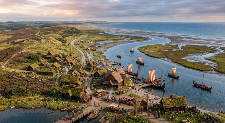
Staby parish lies beside some of western Jutland’s most distinctive water landscapes. Nissum Fjord and Felsted Kog border the area to the north, while Husby Lake lies farther west. Those wetlands and water bodies created opportunities for fishing, grazing, hay production, transport, and access to varied ecological zones.
Geopark Vestjylland’s Staby landscape history describes the parish as bounded by Nissum Fjord, Felsted Kog, and Husby Lake. In later historical periods, rich fishing grounds and extensive meadow areas supported cattle raising and helped make Staby one of the wealthier fjord parishes of western Jutland.
Later prosperity cannot simply be projected backward into the Viking Age.
The landscape still matters.
Viking communities selected settlement locations partly through access to cultivable soils, water, pasture, animals, raw materials, and routes. A site positioned between inland farming zones and a fjord environment could participate in more than one economic sphere.
Nissum Fjord itself covers about 70 square kilometres today. Its geological history shows that western Jutland’s coastline changed significantly over time as marine bays, sediment movement, dunes, and barrier formations reshaped connections between inland water and the North Sea.
Modern maps can therefore mislead readers about earlier accessibility.
A present-day inland-looking settlement may have operated within a far more water-oriented landscape.
Staby offers archaeologists a chance to test how such communities used the boundary between agricultural land, lakes, wetlands, fjord systems, and routes extending farther east.
Western Jutland Already Shows Evidence For Large Viking Communities
Staby becomes more persuasive when researchers compare it with other archaeological sites in the region.
The Holstebro area has produced substantial Viking-Age settlement evidence at several locations. Trap Danmark’s overview of Viking archaeology in Holstebro Municipality identifies settlement remains between Sahl and Vinderup, pit houses near Toftgård, major activity around Trabjerg and Nørre Felding, and a fortified farm at Luren in Mejrup.
The Luren site deserves special attention.
Archaeologists found a farm protected partly by steep natural slopes and partly by a palisade approximately 380 metres long. Researchers date the palisade to around the 10th century and have compared its double-post construction with the roughly contemporary enclosure around Harald Bluetooth’s royal complex at Jelling.
That does not turn western Jutland into another Jelling.
It does show that sizeable farms, defensive investment, villages, and specialized production existed in the region during the Viking Age.
Trabjerg and Nørre Felding produced evidence for settlements composed of several large farms. Archaeologists have also documented increasing craft specialization, including activity inside pit houses.
Staby now enters that regional pattern.
Instead of asking whether western Jutland had meaningful Viking settlement, researchers can ask how those settlements related to each other.
Were some primarily agricultural? Did others control routes or craft production? Which communities linked inland farms with fjord zones? How stable were these settlements across generations?
The 2024 excavation may help answer part of that larger question.
Toarp Shows Why Settlement Networks Matter Beyond Famous Centres
A useful comparison appears in Old Norse News coverage of Toarp’s Viking great farm and wider settlement network. Toarp lies in Skåne rather than Jutland, but the archaeological problem is similar: researchers learn more when they stop treating substantial farms as isolated dots and start examining how nearby settlements, production zones, transport routes, and political centres related to one another.
At Toarp, archaeologists documented a large Trelleborg-type building, pit houses, craft activity, burned-stone deposits, Baltic-style material, and a location close to the royal estate at Oxie. The evidence does not prove that Toarp belonged to a king, but it shows how a settlement can become historically significant through its position within a wider network.
Staby may represent a different version of that same problem.
No royal estate currently anchors the interpretation. Instead, its geography points toward connections between fjord resources, farms, wetlands, and inland movement.
That difference makes Staby especially useful.
If settlement archaeology can reconstruct how such communities exchanged goods, labour, animals, craft products, or information, historians gain a better picture of the infrastructure beneath better-known Viking centres.
The Fjord Landscape Makes “Inland” A Misleading Label
Calling Staby an inland settlement helps distinguish it from a coastal emporium, but the phrase can oversimplify Viking geography.
Western Jutland contained water routes, wetlands, river corridors, lakes, and fjords that created connections far beyond the shoreline.
Nissum Fjord represents one example. The Danish Nature Agency’s history of the Nissum Fjord landscape explains how rising sea levels and post-glacial geological processes shaped broad coastal inlets before sand movement gradually created the barrier landscapes familiar today.
Nearby research has shown the same principle at a wider scale: historical transport could move behind dunes and through connected fjord systems before later silting and coastal change altered those routes.
Archaeologists studying the Viking Age must reconstruct the landscape people actually experienced rather than rely on the modern coastline.
A community near Staby could exploit inland fields without losing access to water-oriented networks.
That dual position may explain why settlement concentrated there.
The strongest version of the hypothesis does not require Staby to have been a port. It only requires the community to occupy a useful node between economic zones.
Farm products could move outward. Fish or other resources could move inland. People, craft knowledge, livestock, and information could travel between settlements even without a formal marketplace.
Such exchanges leave subtler archaeological signatures than a major trading town.
Staby may help researchers see them.
A “Central Periphery” Changes How Western Jutland Looks
Holstebro Museum’s own research history provides a useful concept for interpreting the region.
A research project associated with its aerial archaeology program examined western Jutland’s sea and fjord landscapes during the Late Iron Age, Viking Age, and early Middle Ages under the phrase “a central periphery.”
That wording challenges the assumption that western Jutland sat at the edge of Viking political and economic life.
Peripheral on a map does not always mean unimportant.
The North Sea connected western Denmark with Norway, the British Isles, Frisia, and continental Europe. Inland communities could participate indirectly through local exchange chains even when ships never reached their farms.
Archaeological research in other Danish fjord regions illustrates the principle. Viking settlements can produce foreign objects, imported goods, weights, silver, and evidence for networks extending across Scandinavia, the British Isles, and northwestern continental Europe.
Researchers should not simply transfer those models onto Staby.
The comparison still shows what archaeologists now look for.
Long-distance exchange often depends on layers of local movement. A farm does not need an international harbor to become part of an international economy.
If Staby supplied animals, grain, craft goods, labour, or other resources into chains reaching fjord and coastal centres, its role could have mattered far beyond the settlement itself.
That possibility turns an apparently inland village into a network question.
The September 23 Presentation Could Clarify What The Settlement Actually Did
The next major public step arrives on September 23, 2026.
Holstebro Museum has scheduled a two-hour evening lecture in Folkesalen devoted to the Viking settlement at Staby. The museum promises to present both finds and equipment from the excavation and explain why people repeatedly chose the area.
That wording makes the event particularly relevant.
Archaeologists often learn more from settlement organization than from individual artifacts. House positions, rebuilding phases, pits, wells, fences, craft debris, animal bones, botanical remains, and soil samples can reveal how people used a landscape.
The museum has not yet released all those details publicly.
Readers should avoid filling those gaps with assumptions before specialists present their results.
The safest current interpretation rests on three verified points: archaeological surveys have documented substantial activity at Staby over many years, Viking-Age evidence stands out strongly, and the winter 2024 excavation exposed a Viking settlement within an area already recognized for its cultural heritage value.
Those facts alone make Staby worth watching.
The September lecture may add the house plans, artifact categories, production evidence, or dating needed to determine how the settlement fits within western Jutland’s broader Viking pattern.
Why Staby Could Rebuild Western Jutland’s Viking Network
Staby matters because archaeological networks do not emerge from one spectacular site.
Researchers build them by connecting many settlements through chronology, geography, architecture, production, artifacts, and movement routes.
Western Jutland already contains large farms, villages, pit houses, fortified sites, detector finds, longhouses visible from the air, and landscapes shaped by fjords and wetlands. Staby adds another settlement to that evidence.
Its position makes it especially useful.
The community occupied ground close to Nissum Fjord, Felsted Kog, Husby Lake, pasture zones, and routes extending inland. Archaeologists had detected enough prior activity to classify the area as a cultural heritage zone before digging there in 2024.
The excavation confirmed that the Viking Age formed an important part of the site’s history.
What remains uncertain may prove just as informative as what researchers already know.
No published evidence currently identifies Staby as a royal estate, market town, military centre, or specialized port. Researchers have not yet demonstrated a direct long-distance trade route running through the settlement.
Those labels would outrun the evidence.
A more grounded possibility carries broader significance.
Staby may represent one of the ordinary but strategically positioned communities that connected western Jutland’s local economies. Farms like it could have linked agriculture with wetlands, inland movement with fjord access, and small-scale production with larger exchange systems.
If continuing analysis supports that model, western Jutland will look less like an empty zone between famous Viking centres.
It will look like a populated connective landscape.
That shift explains why the settlement matters. Archaeologists do not need to find a royal hall or silver hoard at Staby for the site to change Viking history. A well-documented settlement can reveal the infrastructure beneath more visible forms of wealth and authority.
The next evidence arrives publicly on September 23.
Until then, Staby already supplies a strong reason to look westward—and inland—when mapping Viking Denmark.
