
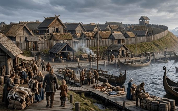
Moesgaard’s Viking Age exhibition turns Aros into a route map from Norway to Constantinople by asking visitors to follow movement rather than memorize a frozen Viking stereotype. The museum presents the exhibition as an expedition through the smoky, narrow alleyways of Aros, the Viking-period Aarhus, before sending visitors across open waters and belts toward Norway’s mountains or along rivers toward Constantinople. This route-based framing matters because it treats the Viking Age as a connected world of towns, ships, river systems, trade, plundering, Christian missions, cargo, and social ambition. For oldnorsenews.org readers, the exhibition offers a useful model: Viking history becomes clearer when museums show how people moved through geography, not just how they fought. (Moesgaard Viking Age exhibition)
Why Aros Makes A Strong Starting Point
Aros gives Moesgaard’s exhibition a powerful opening because it was not a generic Viking settlement. Instead, it was the Viking-period town that later became Aarhus, one of Denmark’s most important cities. VisitAarhus describes the Viking Museum in Aarhus as a window into the Viking town of Aros, founded roughly 1,200 years ago at the same level and spot where the museum now sits beneath Skt. Clemens Torv.
That physical depth matters. A visitor in modern Aarhus can stand above the traces of an older town that managed trade, craft, movement, and defense. Because of that, the Viking Museum’s site context helps people understand that Viking history did not only happen on distant seas. It also happened under later streets, squares, churches, and commercial buildings.
Moesgaard builds on that local foundation. Rather than starting with an abstract map, the exhibition begins with Aros as a lived place and then stretches outward. This design helps visitors connect local archaeology with wider Viking routes.
How The Exhibition Uses Personal Stories
Moesgaard’s exhibition uses personal stories to move visitors through the Viking world. The museum says visitors can choose a person from the Viking Age to follow on an adventure. Options include Queen Tove, Harald Bluetooth’s young bride; 12-year-old Arne; and Reginbrand, the first bishop of Aros. Through them, visitors enter a world of trade, plundering, and discoveries.
That storytelling method matters because routes can become too abstract. A map alone may show distance, but a character creates stakes. For example, a royal bride can introduce politics, marriage, status, and dynastic alliance. Meanwhile, a child can bring daily life and vulnerability into the story. A bishop can then show how Christianity entered towns, courts, and regional power structures.
The exhibition’s strongest move lies in connecting those personal paths with geography. Visitors do not simply learn that Vikings traveled widely. Instead, they follow people through routes that link Aros to Norway, river corridors, and Constantinople. As a result, Viking movement feels practical rather than decorative.
For readers interested in Viking Age trade and expansion, that personal-route structure shows why movement shaped identity. Trade, violence, conversion, and settlement did not float separately. They traveled through the same seas, towns, families, and political networks.
Why Norway Belongs In The Aros Route Map
The exhibition’s route toward Norway’s mountains matters because Norway was not only a distant northern neighbor. It formed part of the same maritime and political world that connected Denmark, the North Sea, the Skagerrak, the Kattegat, and Atlantic routes. Ships could turn geography into opportunity, but they also made weather, coastlines, harbors, and seasonal timing unavoidable.
Moesgaard reinforces that Norway link through a major object: the Gokstad boat. The museum describes it as a 6.5-meter authentic Viking boat from the Gokstad Ship in Norway. In addition, it says Vikings used such a maneuverable boat to row crews and exchange orders between warships. That detail gives the exhibition a concrete Norwegian anchor.
The Gokstad boat matters because it shifts attention from the famous large ship to the smaller craft that made maritime systems work. Long-distance routes required more than impressive hulls. Crews needed tenders, harbor movement, communication between vessels, and practical boat handling. Therefore, a small boat can explain operations that a grand ship alone might hide.
This Norway connection also protects the exhibition from treating Viking routes as fantasy lines on a map. Mountains, coastlines, boats, currents, and ports all mattered. A route to Norway was a test of environment as much as ambition.
Why Constantinople Changes The Scale
Constantinople changes the exhibition’s scale because it pushes the visitor far beyond Scandinavia. The city known in Old Norse as Miklagard stood at the edge of Norse imagination, trade, service, and prestige. A route from Aros toward Constantinople reminds visitors that Viking Age movement did not stop at the North Sea or the British Isles.
Moesgaard’s wording matters here. The exhibition invites visitors to travel via rivers toward “exotic Constantinople.” That route points toward the eastern networks often linked with Scandinavian traders, warriors, and travelers. Rivers connected northern Europe with markets, fortresses, portages, and political centers that could eventually lead toward Byzantium.
However, a museum must handle this topic carefully. Not every Scandinavian traveler reached Constantinople. Likewise, not every object in Scandinavia came through one clean eastern route. Even so, the destination matters as an interpretive tool. Constantinople helps visitors understand that Viking mobility could connect small towns with imperial centers.
That bigger scale makes Aros more interesting, not less. Aros becomes a node in a network. It links local craft and defensive walls to rivers, ships, markets, rulers, and foreign goods.
How Recent Textile News Strengthens The Aros Story
A recent discovery near Aarhus gives Moesgaard’s exhibition fresh relevance. In June 2026, AP reported that archaeologists from Moesgaard Museum found a large Viking Age textile production site at Søften, about 10 kilometers north of Aarhus. The site covers more than 100,000 square meters, dates roughly to AD 600–950, and includes more than 80 pit houses. Archaeologist Liv Stidsing Reher-Langberg led the 10-month excavation. (Søften textile production discovery)
The Søften discovery matters because it shows the kind of production network that could support a town like Aros. Textiles did not appear magically in trade. People processed flax, spun thread, used loom weights and spindle whorls, organized workshops, and moved goods toward larger markets. Moesgaard historian Kasper Andersen told AP that a site of this scale needs a larger network and international perspective.
That current evidence supports the exhibition’s route-map logic. Aros was not only a place where travelers passed through. It belonged to a working regional economy. Rural production, craft specialization, elite control, town exchange, and long-distance routes all connected.
This helps oldnorsenews.org avoid a common Viking mistake. Trade should not appear only as distant silver, swords, and ships. Instead, it also depended on labor sites, textiles, food, craft tools, roads, waterways, and people who never became saga heroes.
Why Aros Was More Than A Gateway
VisitAarhus describes Viking Age Aarhus as a thriving trading town with many different craftsmen. It also notes that merchants had contacts to the north, south, and east. At the same time, Aarhus had a huge defensive wall that controlled movement through the city gates and protected the town from outside attacks.
That combination matters. Aros was open enough to trade and closed enough to defend. A town that welcomed goods also needed ways to manage risk. Walls, gates, craft zones, and merchant contact reveal a place where commerce and control worked together.
Moesgaard’s exhibition uses Aros well because it does not isolate the town from the world around it. The visitor starts in alleyways, then moves outward. That sequence mirrors how towns worked. Local streets led to harbors. Harbors led to seas. From there, seas connected to belts, fjords, rivers, and distant empires.
The route-map idea also changes how visitors understand Viking power. Power did not sit only in royal halls or battlefield victories. It operated through towns that could gather goods, regulate entry, host craftspeople, move ships, and connect local economies to wider routes.
Why Rivers Matter As Much As Seas
Viking history often foregrounds open-sea travel, but Moesgaard’s Constantinople route reminds visitors that rivers mattered too. Rivers carried boats, goods, people, and political influence across inland landscapes. They also created difficult choices: portage points, seasonal water levels, hostile territories, tolls, markets, and changing languages.
A ship leaving a Scandinavian harbor entered a world of logistical decisions. Crews had to plan where to row, sail, beach, repair, trade, and negotiate. River routes could open deep inland movement, but they also demanded knowledge of currents, local power, and practical boat handling.
This is why the exhibition’s geography works. It does not treat Viking travel as one heroic leap. Instead, it breaks travel into linked environments: town streets, open waters, belts, mountains, rivers, and Constantinople. Each environment asks different questions.
Visitors who follow that map can see the Viking Age as a system of movement. The system includes seafaring skill, inland navigation, production sites, market towns, military risk, and cultural contact.
How The Exhibition Counters The Raider-Only Image
Moesgaard does not erase raiding from the Viking Age. Its own exhibition page says the personal stories lead visitors into a world of trade, plundering, and discoveries. That balance matters because a responsible museum should not turn Vikings into peaceful merchants only. Violence, slavery, plundering, and political coercion formed part of the period.
Still, the exhibition refuses to make plundering the only story. Aros brings urban life into the picture. Queen Tove introduces dynastic politics. Reginbrand points toward Christian authority. Arne gives younger visitors a human route into the period. The Gokstad boat explains practical ship communication. Constantinople expands the map toward long-distance ambition.
That mix gives the exhibition better historical texture. Viking Age travel could produce trade in one context and violence in another. A person, ship, or object might move through both worlds during one lifetime. In practice, the same sea routes carried merchants, warriors, missionaries, diplomats, captives, and migrants.
This is the lesson oldnorsenews.org can draw from Moesgaard. The Viking Age becomes more accurate when museums keep contradictions visible.
What The Exhibition Teaches About Museum Design
Moesgaard’s exhibition shows how museum design can teach movement. Instead of arranging the Viking Age only by object type, it builds a journey. Visitors hear personal stories, choose a route, steer a ship, pass through Aros, and encounter destinations that widen the map.
That design helps visitors understand networks. A sword case can show weapon style. A coin case can show exchange. By contrast, a route-based exhibition can show how weapons, coins, people, and ideas moved between places. Movement becomes the organizing principle.
This approach also supports different visitor levels. Children can follow characters and ships. General visitors can grasp trade and travel. More experienced readers can think about political geography, Christianization, river routes, and maritime infrastructure. In other words, a good exhibition works on several layers at once.
Moesgaard’s challenge lies in source clarity. Personal stories can help visitors care, but museums need to show where evidence ends and interpretation begins. Queen Tove, Arne, and Reginbrand can guide a route, while archaeology must still anchor the route.
Why The Gokstad Boat Should Not Be Treated As A Prop
The Gokstad boat in Moesgaard’s exhibition should not function only as an atmospheric Viking object. It connects the exhibition to one of Norway’s most important ship contexts and to the technical systems that made maritime travel possible.
A 6.5-meter boat can teach scale in a way a wall map cannot. Visitors can imagine rowing, maneuvering, crew transfer, and command communication between larger vessels. Because of that, the object turns route planning into physical experience. It reminds people that travel required bodies, timing, and coordination.
That point matters for Norway-focused readers. Viking ships often become national symbols, especially around Oseberg, Gokstad, and Tune. Moesgaard’s use of the Gokstad boat places Norwegian maritime evidence inside a broader Scandinavian exhibition. The object does not stay in a purely Norwegian story. Instead, it helps explain how the Viking world moved.
The boat also shows why small craft deserve more attention. A route map needs more than famous ships. It needs working boats, crews, harbors, docks, storage, weather knowledge, and practical communication.
What Readers Should Verify When Museums Turn Routes Into Stories
Route-based exhibitions can teach well, but they also need careful boundaries. A museum route from Aros to Norway or Constantinople does not prove that every named character took that exact path. It offers an interpretive structure based on historical possibilities, archaeological evidence, and broader Viking Age networks.
Readers should ask several questions. Which objects come from excavated contexts? Which routes rest on archaeological evidence, written sources, or later tradition? Which characters are historical, and which serve as educational guides? How does the museum distinguish trade from raiding, mission work from politics, and local Aros evidence from wider Scandinavian patterns?
Those questions do not weaken the exhibition. Instead, they make it more useful. Moesgaard’s strongest contribution lies in showing that Viking history needs geography. The Viking Age was not only a timeline from AD 800 to AD 1066. It was also a network of places, routes, resources, and decisions.
For oldnorsenews.org readers, that route awareness matters because it turns familiar names into working landscapes. Aros becomes a town with walls and craftspeople. Norway becomes mountains, boats, and maritime links. Constantinople becomes a distant imperial goal reached through river logic, not fantasy.
Why Aros Still Matters For Viking Route Thinking
Aros still matters because it helps modern readers see Viking history from the ground outward. The story begins in a town under present-day Aarhus, moves through regional craft production, crosses waters toward Norway, and stretches by rivers toward Constantinople. Each step widens the map without abandoning the local starting point.
That structure makes Moesgaard’s Viking Age exhibition valuable. It teaches that the Viking world did not consist of isolated raids or heroic voyages alone. Rather, it rested on towns, workshops, boats, defensive systems, routes, markets, royal politics, church figures, and long-distance ambition.
The recent Søften textile discovery reinforces that lesson. Large-scale production near Aarhus shows how regional work could support wider exchange. Aros did not simply watch the Viking Age pass by. It helped organize goods, people, and movement.
Moesgaard’s exhibition therefore turns Aros into more than an old name for Aarhus. It turns Aros into a route map. From smoky alleyways to Norway’s mountains and river roads toward Constantinople, the exhibition shows the Viking Age as a connected world that visitors can follow step by step.
